Postby hemingray » Wed Sep 02, 2009 6:16 pm
You're close to this one! SR-20 to I-80 west, one exit to Yuba Gap, cross the freeway then left on the frontage road. Keep right at the big tree (Snowflower sign) and go about a mile, left on Forest Rd. 19 where it turns to dirt, up a little hill and on your left is a big parking area that you can unload at. Get on your quad, get on the road and explore!
Best spots:
Pass the FR-38 turnoff and continue on FR-19 to the top of the mountain and a big slash pile on right. Turn right there and follow that stub until you come out into nice open area with great views of Signal Peak and Red Mountain and out to the west (the road continues for a bit, then deadends in the trees). On the way back, hang a left at the well-used road to a short scenic overlook of Lake Valley Reservoir on a rocky point. Return to FR-19 and turn right.
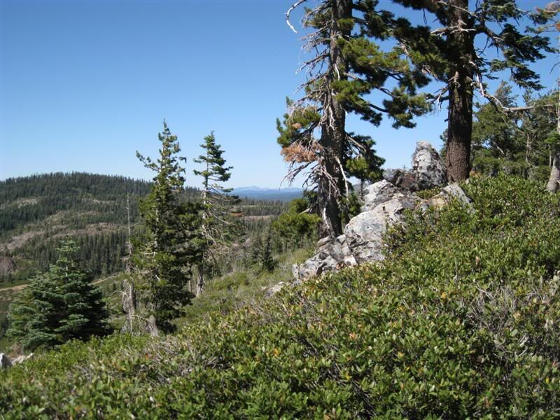
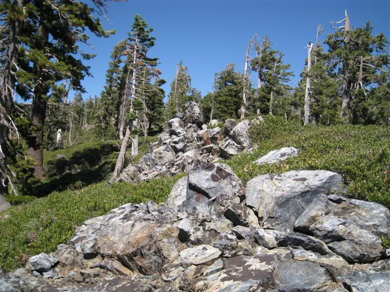
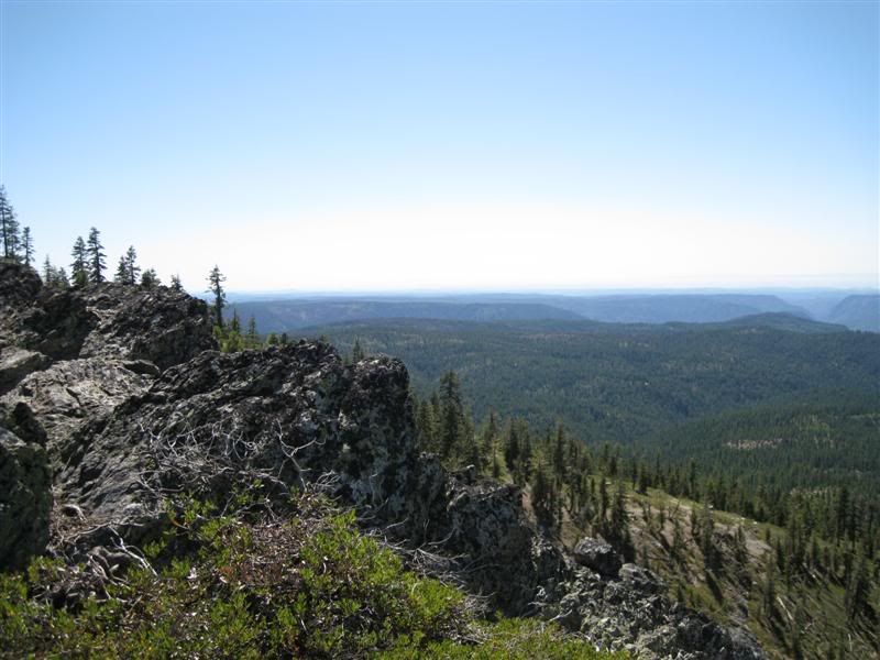
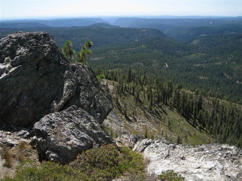
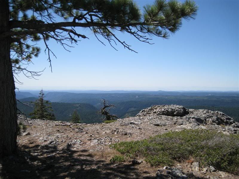
Continue a short distance to the sign for Mears Meadow and turn right through open gate. Take road on left. Continue for about 1/2 mile to Quartz Mountain where the view opens up (there's a travel trailer on it's side here). Enjoy the view, then turn left and follow the ridge down a ways until it dead-ends at the rock hill - these are the views I most recently posted. Follow the foot trail to the left of the rock and it will take you to the views from the top of the rock. Return the way you came. Turn right at FR-19.
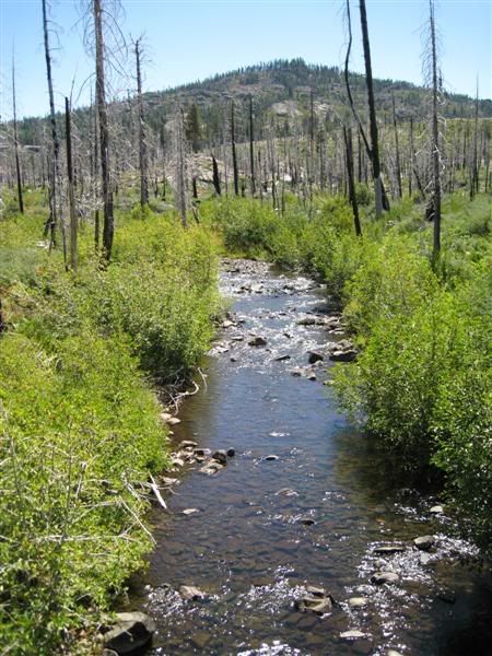
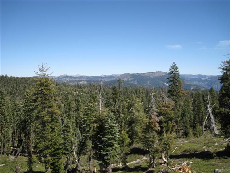
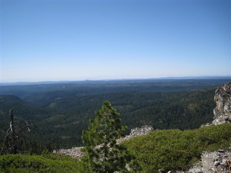
Continue on FR-19, enjoying the views to the east for a few miles (wave at the sign that says Recommended for High Clearance Vehicles and continue somewhat straight ahead -the road bearing right misses the fun ahead). You'll climb some minor (for you on the ATV) hills, then wind through the forest a bit, then the view opens up to your left. Shortly after the views end and you are descending, you will come to the turnoff for Big Valley Bluff on the left. Turn and follow that until it ends - knockout view of the North Fork American River canyon from the old lookout location. As good a view as there can be in the Tahoe. The Foresthill Divide is across from you - the line on the opposite canyon side is the old Iowa Hill Ditch (abandoned).
From here, you can return to FR-19 and turn left and explore more roads - very dusty and less views and the roads get a little more complex and less signed. If you continue down you will come to Dawson Spring and a complex junction. Bear left and that road will take you down Sawtooth Ridge (edge of the canyone), ultimately leading to Helester Point, another old lookout site. Not a scenic view there, but there are some on the way. The change from higher to lower elevation brings a lot of change to the trees and vegetation and it's a pleasant ride, in my book.
Wherever I go, there I am
Paynes Creek 2016!
~~~~~~~~~~~~~~~~~~
16 Yamaha Wolverine R-Spec EPS SE
09 Yamaha Grizzly 700 FI 4x4 EPS