strawberry
Moderator: hemingray
strawberry
anybody know the area around strawberry off 108? just wondering if there is much rideing around there.yoused to go camping there when i was a kid had a camp ground on the south fork of the stanisiaus off of old strawberry road. any info would be helpfull thanks mike
South Side Keeper
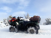
Paynes Creek 2017
Paynes Creek 2017
-
regor
- Just opened an account at Cabelas
- Posts: 72
- Joined: Thu Jun 02, 2005 8:43 am
- Location: sacramento ca
I use to fish the river from beardsley all the way up to donnells. I remember a marked atv trail that we use to cross going down to beardsley. You can also come in from the hwy 4 side at boards crossing. I've rode there before, it's mostly just fs roads. This time of year, depending on snow level it could be interesting. You can go all the way to hells half acre, about 34 miles seems to me. Thats just above beardsley. Great trout fishing from there on up, rough country though.
05 king quad
o4 eiger
08 can am 650 max xt
o4 eiger
08 can am 650 max xt
-
regor
- Just opened an account at Cabelas
- Posts: 72
- Joined: Thu Jun 02, 2005 8:43 am
- Location: sacramento ca
yeah with el dorado nf closed for winter, i'm going to be doing alot more riding up there. You can also go in through Colombia via italian bar road. Here's a link for stanislaus nf http://www.fs.fed.us/r5/stanislaus/miwok/ohv.shtml
05 king quad
o4 eiger
08 can am 650 max xt
o4 eiger
08 can am 650 max xt
-
tinhunter
- Just opened an account at Cabelas
- Posts: 28
- Joined: Sun Oct 21, 2007 9:49 pm
- Location: manteca, ca
There are several areas to ride around Strawberry. There are two specific OHV areas that are nearby and there are several 4wd trails that are pretty fun to ride in the area as well. I believe the trail that Regor is talking about is the Crandall Peak trail. That trail is mostly a fire road that goes from Hwy 4 all the way across Crandall Peak by Beardsley Lake; it is around 37 miles long. I have ridden up in that area several times and there can be some pretty good and challenging 4wd trails in that area.
-
traildad
- Knows UPS driver on a 1st name basis
- Posts: 271
- Joined: Wed Jan 04, 2006 9:13 pm
- Location: Northern California
Could you post more specifics. It is always good to have reliable trail info including road names and good places to stage from. The ride across across from 4 over past Crandall Peak would be fun. Thanks. Kentinhunter wrote:There are several areas to ride around Strawberry. There are two specific OHV areas that are nearby and there are several 4wd trails that are pretty fun to ride in the area as well. I believe the trail that Regor is talking about is the Crandall Peak trail. That trail is mostly a fire road that goes from Hwy 4 all the way across Crandall Peak by Beardsley Lake; it is around 37 miles long. I have ridden up in that area several times and there can be some pretty good and challenging 4wd trails in that area.
05 Yamaha Kodiak 450, Mine
05 Yamaha Kodiak 450, Wife's
We love to go Trail Riding and "ATV Backpacking"
05 Yamaha Kodiak 450, Wife's
We love to go Trail Riding and "ATV Backpacking"
-
tinhunter
- Just opened an account at Cabelas
- Posts: 28
- Joined: Sun Oct 21, 2007 9:49 pm
- Location: manteca, ca
The two OHV areas near there are: Crandall Peak/Deer Creek OHV areas, and Hull Creek/Trout Creek OHV areas. These areas are mostly just fire roads with some double track trails mixed in as well. You can find info on these two areas on riderplanet.com.
The Crandall Peak trail can be ran either direction. The top starts near Strawberry on 4N39; there are no real staging areas since this is mostly a fire road that is used by all off road vehicles. I just pull off somewhere big enough for my truck and run my quad. The trail runs all the way down to HWY 4 near the town of Vallecito and there is a spur that breaks off the main trail down to the Stanislaus river and there is a campground down there; Beardsley Lake is just down stream from the campsite. The trail changes designations several times, it starts out as 4N39 then becomes 4N01 then 3N03 and Camp Nine Road near Vallecitos. The trail is only a fire road and isn't technical in any way; it is just an easy drive across the mountains for the scenery.
Some of the other 4WD trails in the area are: Eagle Peak, and Dodge Ridge. Eagle Peak is rated as moderate for jeeps and Dodge Ridge is rated as easy for jeeps. Dodge Ridge is near Hull Creek OHV area and if you run it up hill, the only way I have gone, you can stage across the road from Fahey Cabin on F.R. 31. This is an easy trail that goes along the ridge up near Pinecrest Lake. There are some more challenging trails that break off this trail that are part of the Hull Creek system; I haven't explored all of the area yet since I am usually by myself. I haven't ridden the Eagle Peak trail yet.
I think the HWY 4 area around Bear Valley, Blue Lakes and Lake Alpine provide some more interesting trails to ride on though and some of those are rated as difficult or expert level for jeeps. I think the trails that run around HWY 4 and 88 provide better scenery with all of the granite outcroppings. I used to explore most of these areas with my Bronco and I have only in the past year or so started running them with my atv, so that is the reason for the jeep references.
I hope this helps some. I do have specific GPS coordinates for some of the trails as well.
-
traildad
- Knows UPS driver on a 1st name basis
- Posts: 271
- Joined: Wed Jan 04, 2006 9:13 pm
- Location: Northern California
Yes thanks. Great info. Sounds like a good ride to take the wife on. It can be hard to tell what is what just looking at the maps. It sounds like you can camp and ride from the campsite near Beardsley Lake. That is always good to know. Thanks
tinhunter wrote:The two OHV areas near there are: Crandall Peak/Deer Creek OHV areas, and Hull Creek/Trout Creek OHV areas. These areas are mostly just fire roads with some double track trails mixed in as well. You can find info on these two areas on riderplanet.com.
The Crandall Peak trail can be ran either direction. The top starts near Strawberry on 4N39; there are no real staging areas since this is mostly a fire road that is used by all off road vehicles. I just pull off somewhere big enough for my truck and run my quad. The trail runs all the way down to HWY 4 near the town of Vallecito and there is a spur that breaks off the main trail down to the Stanislaus river and there is a campground down there; Beardsley Lake is just down stream from the campsite. The trail changes designations several times, it starts out as 4N39 then becomes 4N01 then 3N03 and Camp Nine Road near Vallecitos. The trail is only a fire road and isn't technical in any way; it is just an easy drive across the mountains for the scenery.
Some of the other 4WD trails in the area are: Eagle Peak, and Dodge Ridge. Eagle Peak is rated as moderate for jeeps and Dodge Ridge is rated as easy for jeeps. Dodge Ridge is near Hull Creek OHV area and if you run it up hill, the only way I have gone, you can stage across the road from Fahey Cabin on F.R. 31. This is an easy trail that goes along the ridge up near Pinecrest Lake. There are some more challenging trails that break off this trail that are part of the Hull Creek system; I haven't explored all of the area yet since I am usually by myself. I haven't ridden the Eagle Peak trail yet.
I think the HWY 4 area around Bear Valley, Blue Lakes and Lake Alpine provide some more interesting trails to ride on though and some of those are rated as difficult or expert level for jeeps. I think the trails that run around HWY 4 and 88 provide better scenery with all of the granite outcroppings. I used to explore most of these areas with my Bronco and I have only in the past year or so started running them with my atv, so that is the reason for the jeep references.
I hope this helps some. I do have specific GPS coordinates for some of the trails as well.
05 Yamaha Kodiak 450, Mine
05 Yamaha Kodiak 450, Wife's
We love to go Trail Riding and "ATV Backpacking"
05 Yamaha Kodiak 450, Wife's
We love to go Trail Riding and "ATV Backpacking"
Who is online
Users browsing this forum: No registered users and 25 guests